
Earth systems are complex, and building a sustainable future depends on understanding how they work. Here, you will study those systems up close, supported by faculty who are leaders in climate science, atmospheric research, geophysics, hydrology, resource sustainability, and more.
Our Master of Engineering degree allows you to create a plan of study that will deepen your expertise in one area or enable you to explore interdisciplinary research. Our faculty have an incredibly wide range of interests and specialties and work closely with M.Eng. students to reach your tailored goals. Your hands-on project becomes the heart of your degree, allowing you to turn ideas into impact while building the skills and confidence to lead in your field.
-
30 Credits
typically completed in just one year.
-
Fall or Spring Start
for added flexibility.
-
Hands-on Design Project
Real-world experience instead of a research thesis.
-
Bachelor’s degree in Earth and atmospheric sciences not required.
Build the Scientific Expertise and Problem-solving Skills Needed to Lead.
-
Learn from Leading Researchers
Study and collaborate with world-renowned faculty advancing climate and Earth science knowledge.
-
Design Your Path
Tailor your coursework across engineering, environmental science, and sustainability fields, and gain a holistic understanding of the field.
-
Access to Advanced Facilities
Use cutting-edge computational tools, modeling platforms, research labs, and visualization resources across Cornell.
-
Grow a Strategic Network
Tap into Cornell’s vast alumni network and industry partnerships, opening doors to exciting career opportunities in government, private sector, and non-profit organizations.
Concentration Areas
Choose from one of our concentration areas or build a customized curriculum to meet your unique career goals.
-
Atmospheric Science
Meteorology, applied climatology, air quality, aerosols, and climate change. Use of large datasets and computational models.
-
Remote Sensing
Remote sensing involves utilization of satellite- and airborne-based remote sensing approaches for time series analysis, land-use change, and understanding of subsurface phenomena. Use of large datasets and GIS technology.
-
Subsurface Resources and Energy Systems
Energy reservoirs and subsurface energy engineering, including geomechanics, flow in porous media, geology, geochemistry, numerical modeling, and Artificial Intelligence.
-
Applied and Environmental Geophysics
Geophysics, seismology, geology, porous media flow, and computer methods. Methods include field work, laboratory testing, numerical modeling, and AI.
-
Is This Master’s Degree the Right Fit for You?
Students join us from a wide set of undergraduate degrees including aeronautical engineering, environmental science, physics, and geology. Both the Master of Science (M.S.) and Master of Engineering (M.Eng.) are rigorous graduate degrees, but they are designed for different goals and learning styles.
-
M.Eng. Details
- Two semesters, often completed in less than a year
- Focused on professional preparation but also suitable for PhD preparation
- Hands-on project instead of a traditional thesis
- Funded by the student – applications for fellowships have to be submitted early on
-
M.S. Details
- Typically takes two or more years
- Focused on research and academic inquiry
- Traditional research thesis
- Can be funded on research grants or teaching assistantships, if available
The M.Eng. Project
Work on an individualized project that applies scientific principles to real-world environmental challenges, giving you practical experience that employers value. Recent M.Eng. projects from our students include:
-
Quantifying Earth Glacier Displacement to Inform Interpretation of Martian Glacial Landforms
M.Eng. Student: Tyler Foote
Advisor: Rowena LohmanThis project utilizes Google Earth Engine to analyze and track the displacement of the Columbia Glacier over time using multi-temporal satellite imagery. The objective is to develop an accessible framework for leveraging time-series remote sensing data to quantify glacial motion. By examining temporal patterns of glacier displacement on Earth, the study also seeks to identify and interpret potential analogs for glacial features on Mars. These comparisons may help inform future investigations into subsurface ice deposits and the history of past glacial periods on Mars.
-
Analysis of PM2.5 Pollution and Industrial Emissions in Jiangsu Province
M.Eng. Student: Laurel (Yijing) Lu
Advisor: Natalie M. Mahowald“My work is motivated by the need to better understand long-term air pollution patterns in the Jiangsu–Zhejiang–Shanghai region and their possible links to economic activity, industrialization, and environmental regulation. Specifically, I am studying how PM2.5 concentrations have changed over the past 25 years, which province in the region experiences the most severe pollution, how PM2.5 is distributed across cities within that province, and which factors are most strongly associated with PM2.5 levels. To address these questions, I am using temporal trend analysis, spatial comparison across provinces and cities, and correlation-based analysis with environmental variables such as sulfur dioxide, nitrogen oxide, and particulate emissions. My preliminary findings suggest that pollution is not evenly distributed across the region, and that industrial emissions appear to have a strong relationship with PM2.5 concentrations in the most heavily affected areas.”
-
Inverse Modeling Earthquake Fault Planes Using InSAR and Statistical Analysis
M.Eng. Student: Nicholas Zajac
Advisor: Rowena LohmanThe goal of this project is to use Interferometric Synthetic Aperture Radar (InSAR) data to inverse model the fault plane of an earthquake in Eastern Iran. Through developing this program, statistically optimal estimates of fault plane geometry can be produced from InSAR displacement data for any suitable earthquake.
A variety of statistical methods are being used, including quadtree regression, optimizations techniques such as grid search and Levenberg-Marquardt, and residual analysis.
The preliminary results are encouraging. The multiple optimization approaches have produced reasonable and consistent parameter estimates and the resulting fault plane geometry aligns well with the original InSAR displacement data.
News and Updates
-
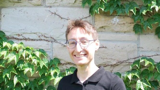
![Chloe Arson]()
Chloé Arson is reimagining the M.Eng. in earth science and engineering
This year marks a turning point for the Earth and Atmospheric Science M.Eng. program. With the arrival of Chloe Arson as a professor and also director of M.Eng. Programs, the department is taking a fresh look at what the degree can become.
-
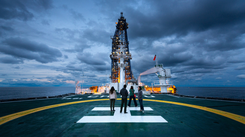
![On the deck of the deep-sea drilling ship Chikyu, the vessel for the International Ocean Discovery Program Expedition 405.]()
Hidden clay intensified 2011 Japan megaquake, study confirms
An international research expedition involving Cornell has uncovered new details as to why a 2011 earthquake northeast of Japan behaved so unusually as it lifted the seafloor and produced a tsunami that devastated coastal communities.
-
![]()
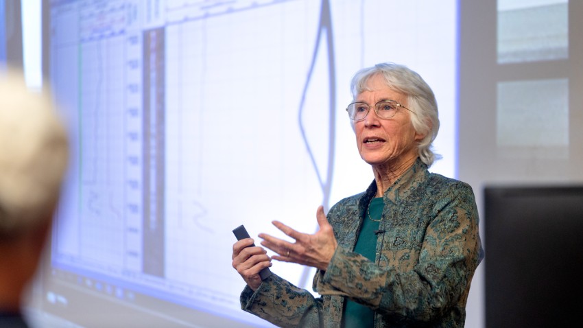
Geothermal experts say borehole data shows promise
Nearly 175 community members joined a town forum Nov. 3, held in person and online, to hear updates on the Cornell University Borehole Observatory.
-
![Mineral microbes]()
Microbe atlas could reveal how to mine critical metals sustainably
A Cornell-led team will use a $2 million National Science Foundation grant to develop a “microbe-mineral atlas,” a catalog of microorganisms and how they interact with minerals, key for mining critical metals used for generating sustainable energy.

Career Placement
-
Job Title Examples
- Business Development
- Engineer
- Geologist
- Staff Geologist
- Visiting Scholar
- Visiting Scientist
-
Featured Employers
- Arcadis
- Consulting Services Incorporated
- FBI Lab/ORISE Fellowship
- Huawei
The Graduate Student Handbook, travel reimbursement forms, scholarship applications, and other student resources are available at Graduate Student Resources and Forms.
Contact
-
Sierra Henry
Sierra Henry
Graduate Field Assistant
Snee Hall, Room 2160A
EASgradprograms@cornell.edu -
General Information